Shaping the Emerald City: How Glaciers and Humans Built Seattle

NASA's "Shaping the Emerald City" feature examines Seattle's unique development. Using new ISS astronaut photography, the report illustrates how ancient glacial activity formed the city's topography, while extensive human engineering—from leveling hills to altering waterways—defined its modern urban landscape. This history highlights the city's complex relationship with nature.
Read it in Short
QUICK OVERVIEW
NASA released new ISS imagery on July 20, 2026, showcasing Seattle's geological and urban evolution.

The city’s unique hilly topography was formed by glacial drumlins deposited 18,000 to 16,000 years ago.

Human engineering drastically reshaped the city, including reclaiming 1,300 acres of tideflats and lowering Lake Washington by 9 feet.
High-resolution photos from the ISS Nikon Z9 camera provide essential data for modern urban and coastal planning.
Shaping the Emerald City: How Glaciers and Humans Built Seattle
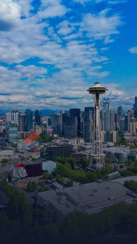
To the modern observer, Seattle appears as a masterclass in urban density—a vertical forest of glass and steel pinned between the deep blue of Puget Sound and the snow-capped peaks of the Cascades. Yet, the Seattle of 2026 is merely the most recent layer in a geological and industrial saga that began nearly 20,000 years ago. A new feature from the NASA Earth Observatory, released on July 20, 2026, pulls back the curtain on this evolution, utilizing high-resolution imagery from the International Space Station (ISS) to demonstrate how the city is a living monument to both tectonic forces and human ambition.
The View from Orbit: Capturing a Dynamic Landscape

On June 16, 2026, the crew of ISS Expedition 74 directed a Nikon Z9 digital camera toward the Pacific Northwest. Using a 560mm focal length lens, the astronauts captured image ISS074-E-723719, a striking visual dataset that serves as the centerpiece for the NASA report. This is not merely a pretty landscape photo; for geologists and urban planners, it provides a high-fidelity view of how human infrastructure now sits atop a landscape literally carved by the movement of the Cordilleran ice sheet.
The choice of equipment is significant. The Nikon Z9's ability to resolve fine detail from an orbital altitude of hundreds of kilometers allows researchers to track urban sprawl and coastal changes with precision that previous generations of satellite imagery could not match. By comparing these current shots to geological survey data, scientists can observe how the city’s footprint has settled into the unique terrain left behind by the last ice age.
Glaciers, Drumlins, and Erratics: The Foundation
Seattle’s signature topography is not accidental. Between 18,000 and 16,000 years ago, the Puget lobe of the Cordilleran ice sheet scoured the region, creating the deep basins of Puget Sound and local lakes. As the ice retreated, it deposited elongated mounds of debris known as drumlins. These drumlins dictate the north-south orientation of many of the city’s hills today.
Further evidence of this icy past can be found in "glacial erratics"—massive boulders transported hundreds of miles by ice and deposited as the glaciers melted. The most famous example is Wedgwood Rock, a silent, ancient testament to a time when Seattle was buried under thousands of feet of ice. These features remain the "hidden" skeleton of the Emerald City, forcing modern roads and buildings to curve around natural mounds that refuse to be ignored.
Engineering the Modern Waterfront
While glaciers provided the foundation, human engineering provided the structure. The Seattle of today bears little resemblance to the coastal geography of the 19th century. Through massive civil engineering projects, the city essentially reconstructed its own geography:
- Leveling the Land: Large-scale regrading projects eliminated massive hills, such as Denny Hill, to create buildable urban surface area.
- Filling the Tides: The city filled in the original tideflats at the mouth of the Duwamish River, reclaiming approximately 1,300 acres of land to house the growing industrial sector.
- Hydrological Overhaul: The 1910s construction of the Lake Washington Ship Canal and the Ballard Locks fundamentally altered the region’s drainage. By connecting Lake Washington to the Puget Sound, engineers lowered the lake level by roughly 9 feet, permanently changing the shoreline and the city’s internal hydrology.
Comparison: Seattle Before and After Development
| Feature | Natural State (Pre-1900s) | Engineered State (Modern) |
|---|---|---|
| Lake Washington Levels | Higher, independent drainage | Lowered by 9ft via Ballard Locks |
| Duwamish River Mouth | Expansive tidal marshes | 1,300+ acres of reclaimed land |
| Downtown Topography | Steep, irregular hills | Regraded/flattened for transit |
Troubleshooting Access and Image Data
For those interested in exploring these NASA assets, the data is entirely public domain and free to the public. However, researchers and hobbyists should be aware of a few logistical realities when navigating the Gateway to Astronaut Photography of Earth:
- Bandwidth Constraints: The NASA/JSC portal hosts massive high-resolution TIF files. If these are failing to load, users should switch to the NASA Earth Observatory article page, which provides optimized, web-ready previews of the same imagery.
- Weather Interference: While the June 2026 capture was exceptionally clear, the Pacific Northwest is notoriously cloud-covered. Users looking for specific historical snapshots may find images obscured by the region’s persistent marine layer; always check the "cloud cover" metadata field on the JSC portal before attempting a large download.
Why It Matters
The study of Seattle as a "living" geological site is critical for modern infrastructure. The 2010-era waterfront upgrades, including the construction of sophisticated new seawalls, are designed not just to host luxury terminals and public spaces, but to protect a city that has spent a century fighting against, and building upon, a complex water-bound geography. By observing the city through the lens of ISS imagery, we gain a long-term perspective on how urban development—once a battle against nature—is transitioning into a more conscious dialogue with the landscape.
📖 NASA Coverage Timeline (Story Graph)
Follow the chronological evolution of NASA updates and related announcements on HeadlineDock:
- Jun 23, 2026 — Interstellar Comet 3I/ATLAS Likely Far Older Than Solar System, Astronomers Say
- Jun 26, 2026 — International Space Station Faces Growing Safety Risks from Persistent Air Leaks
- Jun 28, 2026 — NASA Launches Daring Rescue Mission to Save Aging Swift Observatory
- Jun 28, 2026 — Why Nuclear Power in Space is Essential for Future Interplanetary Missions
- Jul 08, 2026 — Why Former NASA Chief Questions Artemis Moon Lander Plans Complexity
- Today — Active Coverage: (You are reading this article)
Frequently Asked Questions
Why is Seattle called the "Emerald City"?
The nickname refers to the lush green appearance of the city's parks, tree-filled neighborhoods, and old-growth forests within city limits.
How did glaciers shape Seattle's hills?
Many of Seattle's hills are drumlins—elongated mounds of glacial debris deposited during the last ice age, oriented north-south in alignment with glacial movement.
What major engineering project changed Seattle's water systems?
The construction of the Lake Washington Ship Canal and the Ballard Locks (1916) connected Lake Washington to Puget Sound, lowering the lake's water level by roughly 9 feet.
How can I access the images mentioned in this report?
The images are available for free via the NASA/JSC Gateway to Astronaut Photography of Earth or through the original NASA Earth Observatory article page.