Severe Storms Bring Heavy Snow and Flooding to New Zealand South Island

A severe weather system has hit New Zealand's South Island, causing significant surface flooding in Dunedin and heavy snowfall across mountain passes. Civil Defence is managing emergency responses as the system moves northward, with residents urged to exercise caution amid ongoing travel and safety alerts.
KEY TAKEAWAYS
1 MIN READ- Civil Defence bunker activated in Dunedin following heavy rain and flooding.
- Severe road snowfall warnings issued for major South Island mountain passes.
- Coastal Otago remains under an orange heavy rain warning until Monday.
- Authorities advise avoiding non-essential travel while monitoring low-lying areas.
A severe weather system has swept across the South Island of New Zealand, bringing heavy rainfall, biting snow, and intense winds that have triggered emergency responses across the region. While MetService Auckland updates remain a focal point for many, the immediate crisis is concentrated in Dunedin and coastal Otago, where local authorities have activated the Civil Defence bunker to manage the unfolding situation.
Emergency Response to Severe Weather
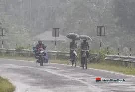
The intense downpour, which arrived earlier than forecast, has resulted in widespread surface flooding and minor land instability. Residents in South Dunedin have been particularly affected, leading to proactive measures such as the deployment of flood protection barriers and the establishment of sandbagging stations. The Dunedin City Council has urged citizens to avoid non-essential travel and remain vigilant as the weather remains fluid.
Beyond the flooding, the South Island is battling significant snowfall. Road snowfall warnings are currently active for critical routes, including the Lindis Pass, Crown Range Road, and the Milford Road. Authorities have cautioned motorists that conditions are treacherous, with snow levels expected to persist above 300 metres in some areas. Meteorologists anticipate that this broad, low-pressure system will continue moving northward, bringing further rain and gale-force winds as it impacts parts of the North Island throughout the coming days.
Impacts and Safety Measures
As officials monitor the Water of Leith and other river systems, the priority remains public safety. While no major infrastructure failures have been reported, the Otago Regional Council and weather forecasters are collaborating closely to monitor river levels. With up to 100mm of rain projected in certain coastal areas, the situation is being treated as a significant regional event.
Residents are advised to keep emergency supplies ready and maintain contact with local authorities. Those who feel unsafe are encouraged to relocate to the homes of friends or family, while anyone facing immediate danger is urged to contact emergency services without delay. Despite the current difficulties, experts note that the snowfall may lead to improved skiing conditions for the upcoming school holidays once the front clears mid-week.